Through careful grading or landforming design, you can increase efficiency and yields while conserving both topsoil and water.
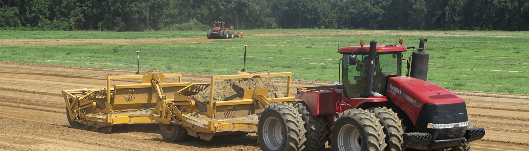
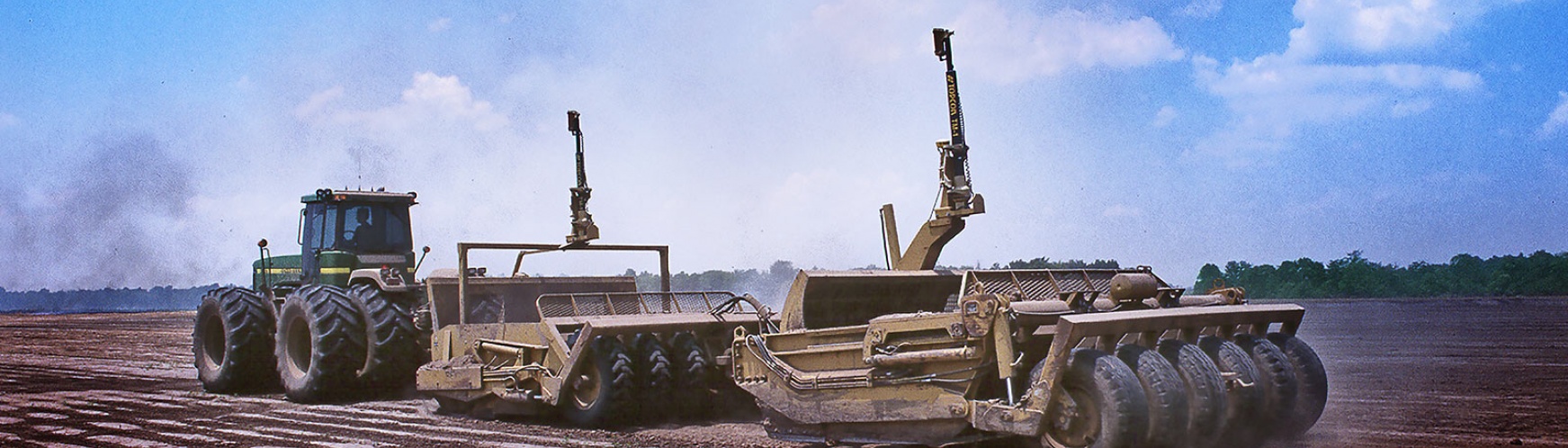
The Topcon GNSS solution allows the operator to survey, create cut/fill maps and start grading without ever leaving the cab. GNSS (GPS + GLONASS) satellite reception standard provides maximum accuracy, with either single or dual scraper control. Grade more than 12,000 acres in a single setup, and work 24/7, even in dusty conditions.
Use variable slopes to reduce volumes moved
AGForm-3D state-of-the-art survey and design software includes the Topcon Variable Slope PWCS field design module that has revolutionized land leveling by significantly reducing the volume of material moved, and by keeping design surfaces closer to the original terrain.
You get complete control with the ability to survey, design and create plots and reports in a single program, with no per-acre fees or extra charges.
Easy to Get Started
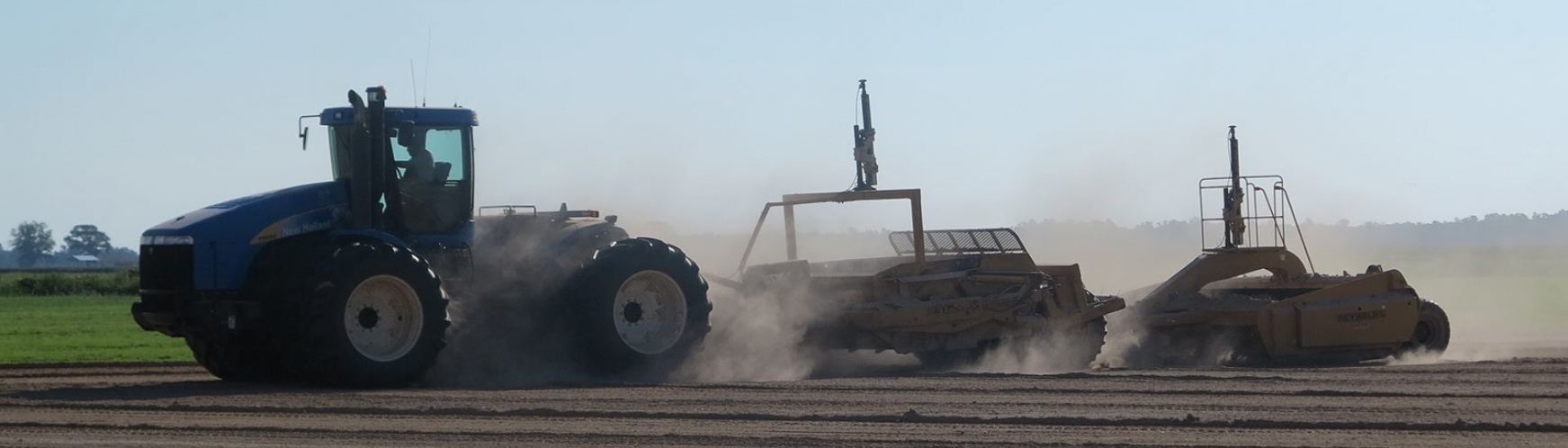
The best of both worlds in a single solution. World's best Autosteering. World's best Landleveling.
Use Variable Slope PWCS to Reduce Volumes Moved
AGForm-3D state-of-the-art survey and design software includes the Topcon Variable Slope PWCS field design module which has revolutionized land leveling by significantly reducing the volume of material moved and by keeping design surfaces closer to the original terrain.
You get complete control with the ability to survey, design and create plots and reports in a single program, with no per-acre fees or extra charges.
|
|
Autosteering adds efficiency and stress relief |
|
Select single or dual scraper control, and options from basic manual indication to fully automatic machine control. Set very fine increments of either single or dual slopes at the laser transmitter, and the control system has accurate reference anywhere on your field. And if you need to reset your laser, Topcon provides the best repeatability on the market.
|
|
Use less water, get better results A properly leveled (or slightly sloped) field promotes even and efficient irrigation. You use less water, the crop grows better and more evenly, and your soil is retained. The Topcon land leveling solution provides a survey function that measures, then averages elevations so you can more easily achieve proper leveling, or even maintain roads and ditch pads as well. |
Durability, visibility, repeatability Topcon laser land leveling solutions have been at work for decades, and that experience results in a rugged dependable solution delivering great accuracy repeatably, year in, year out. Each component of the solution is optimized with the features that matter and are easy to use. All displays, from the transmitter to the receiver to the control box are bright and easily readable in bright sunlight, with indicators that make sense. |
|
|
|
|
|
|
Complete GNSS Landforming Survey and Design software It is no mystery drainage has one of the greatest impacts on yield. AGForm-3D optimizes drainage while moving the least soil possible, reducing inputs and retaining maximum fertility. It sets a proper foundation for all other precision technology to thrive. AGForm-3D is an easy and intuitive solution for improving surface drainage and irrigation efficiency. It offers state-of-the-art surveying (coupled with a Topcon mobile base, such as the HiPer V or GR-5) and design in a single program, producing single, dual or variable-slope patterns to ensure optimal drainage. Designs are directly imported to guide your Topcon GNSS landforming solution mounted in a single or dual scraper configuration. AGForm-3D enables independence and with no per-acre fees, it’s an investment that generates value immediately. Features include:
|
Click Here for the Topcon Precision Agriculture Global site

View the full Topcon Agriculture Solutions Catalog here


